


Tide's Out
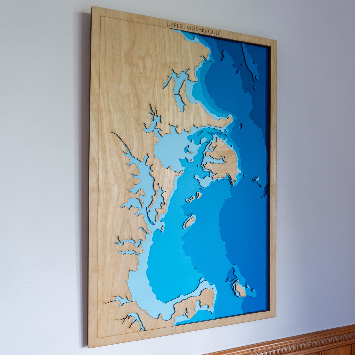
Upper Hauraki Gulf I, Auckland Region, New Zealand - Large
Upper Hauraki Gulf I, Auckland Region, New Zealand - Large
Couldn't load pickup availability
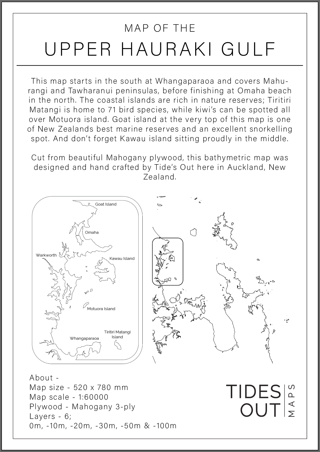
🗺️ Upper Hauraki Gulf Wooden Depth Map - Large
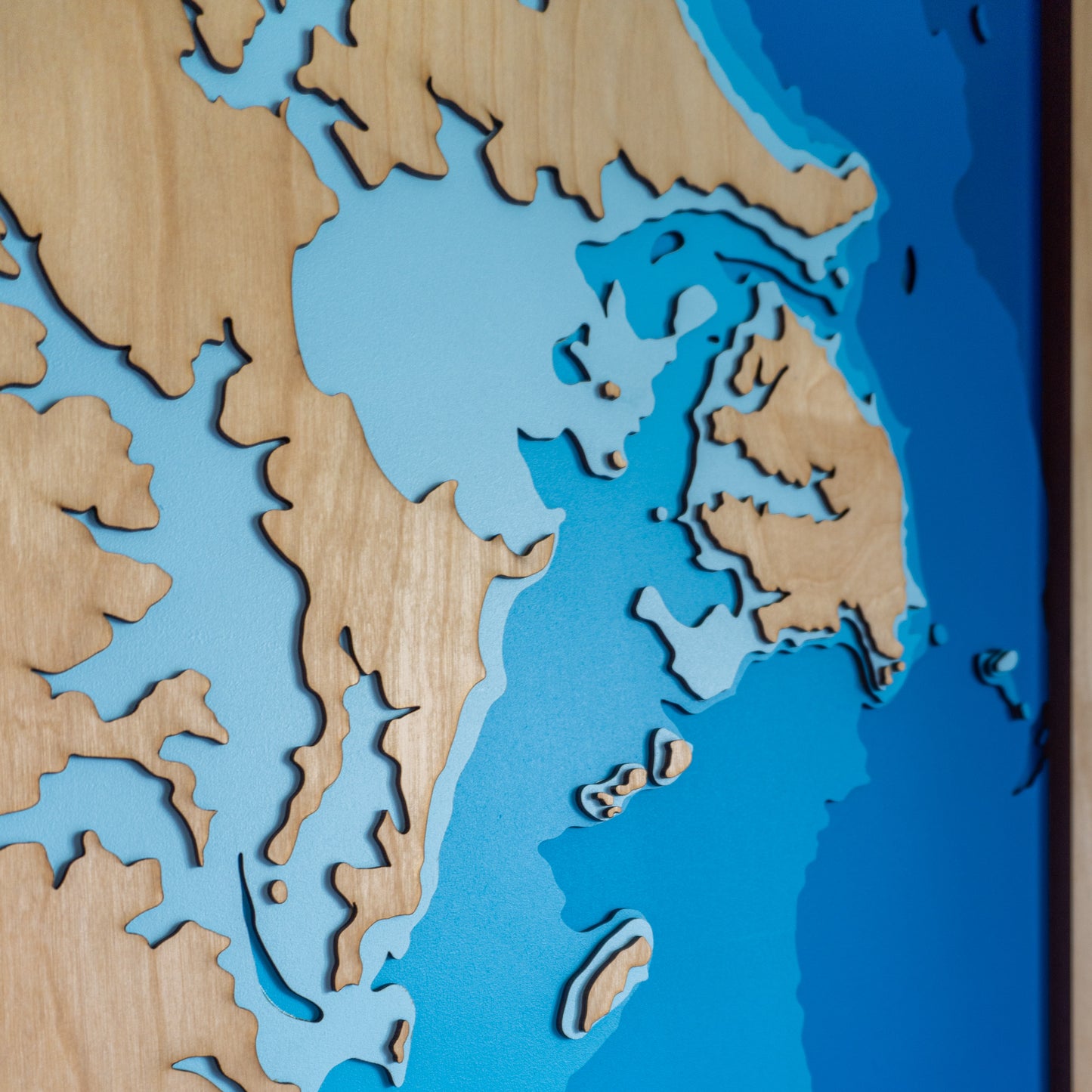
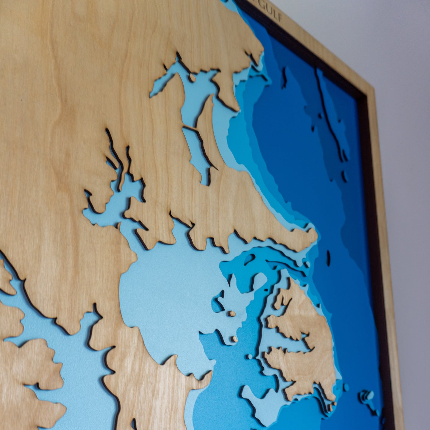
This handcrafted wooden map showcases the upper Hauraki Gulf, stretching from Omaha in the north to Whangaparaoa in the south. At its centre sits Kawau Island—one of the largest and most iconic islands in the Gulf. Known for its rich history and natural beauty, Kawau is a beloved retreat for both visitors and locals alike.
Whether it’s a reminder of holidays, boating adventures, or a connection to place, this map brings the coastal landscape to life through layered depth and fine craftsmanship.
✨ Why You’ll Love It
-
Handmade in New Zealand with precision and care
-
Laser-cut layers show the seafloor's natural contours
-
Assembled by hand using sustainably sourced European Birch
-
A beautiful keepsake for island lovers and coastal adventurers
-
Personalisation available for names, dates, or special places
📏 Size: Large (80 x 55 cm)
🪵 Plywood: European Birch
🌊 Layers: Sea level, -10m, -20m, -30m, -50m, -100m
🛠️ Lead Time: Made to order – allow up to two weeks for build
✍️ Want to personalise your map?
Click ‘Add a Bespoke Addition’ and write a note with your order—we’ll be in touch to customise your piece just for you.