


Tide's Out Maps
Matakana Island, Bay of Plenty, New Zealand – Small
Matakana Island, Bay of Plenty, New Zealand – Small
Couldn't load pickup availability
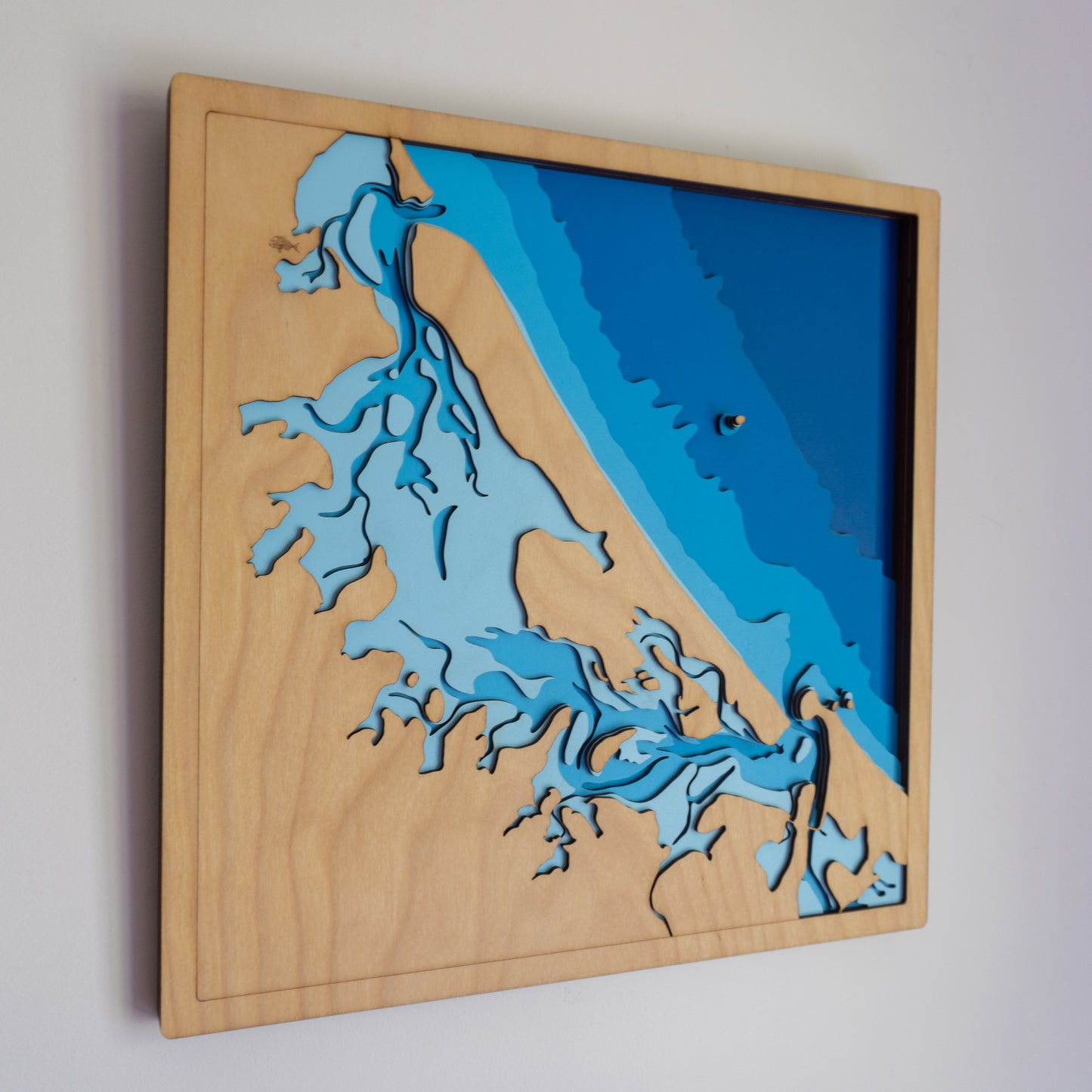
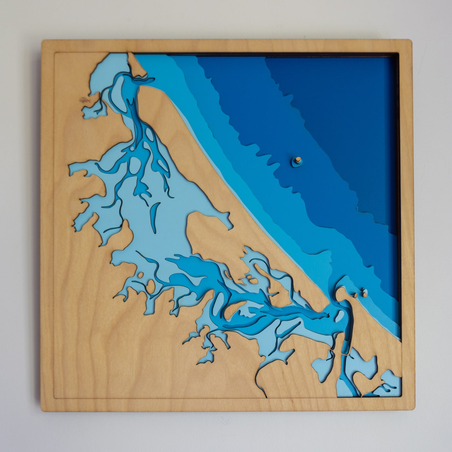
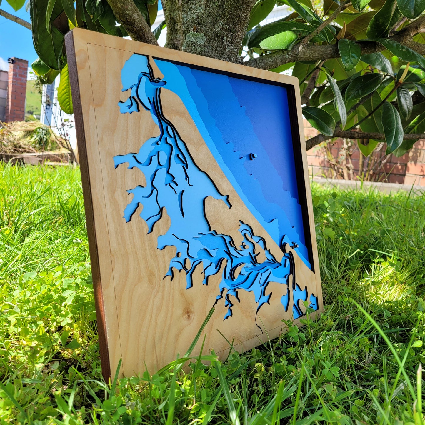
🏝️ Matakana Island Wooden Depth Map – A Handcrafted Slice of the Bay of Plenty
Celebrate the beauty of the Bay of Plenty with this handcrafted wooden map of Matakana Island — a stunning representation of one of New Zealand’s most distinctive coastal landscapes.
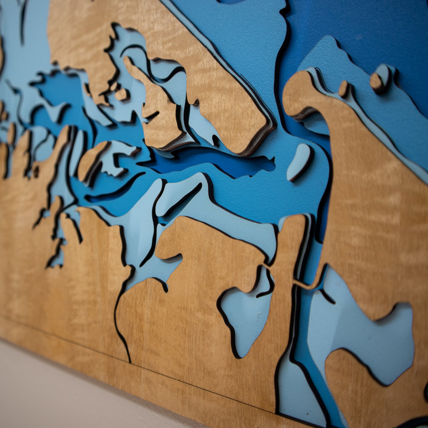
This piece captures the upper Bay of Plenty region in remarkable detail, from Bowentown Peninsula in the north to Tauranga and Mount Maunganui in the south. The intricate, winding channels of the tidal Matakana Harbour are brought to life layer by layer — perfect for locals, bach owners, or anyone who treasures this slice of Aotearoa.
🔍 Why You’ll Love This Map:
-
Features the coastlines and tidal inlets around Matakana Island
-
Handcrafted in New Zealand using sustainable European Birch plywood
-
Precision laser-cut and assembled by hand for stunning depth and detail
-
A meaningful gift or keepsake for Bay of Plenty locals and beachgoers
-
Option to personalise with names, locations, or dates
📏 Size: Small (40 x 40 cm)
🪵 Material: European Birch plywood
🌊 Depth Layers: Sea level, -2m, -5m, -10m, -20m, -50m
🛠️ Made to order – please allow up to 2 weeks for your custom-built map.
✍️ Want to add a bespoke touch? Add a note to your order and we’ll be in touch with personalisation options.