
Tide's Out Maps
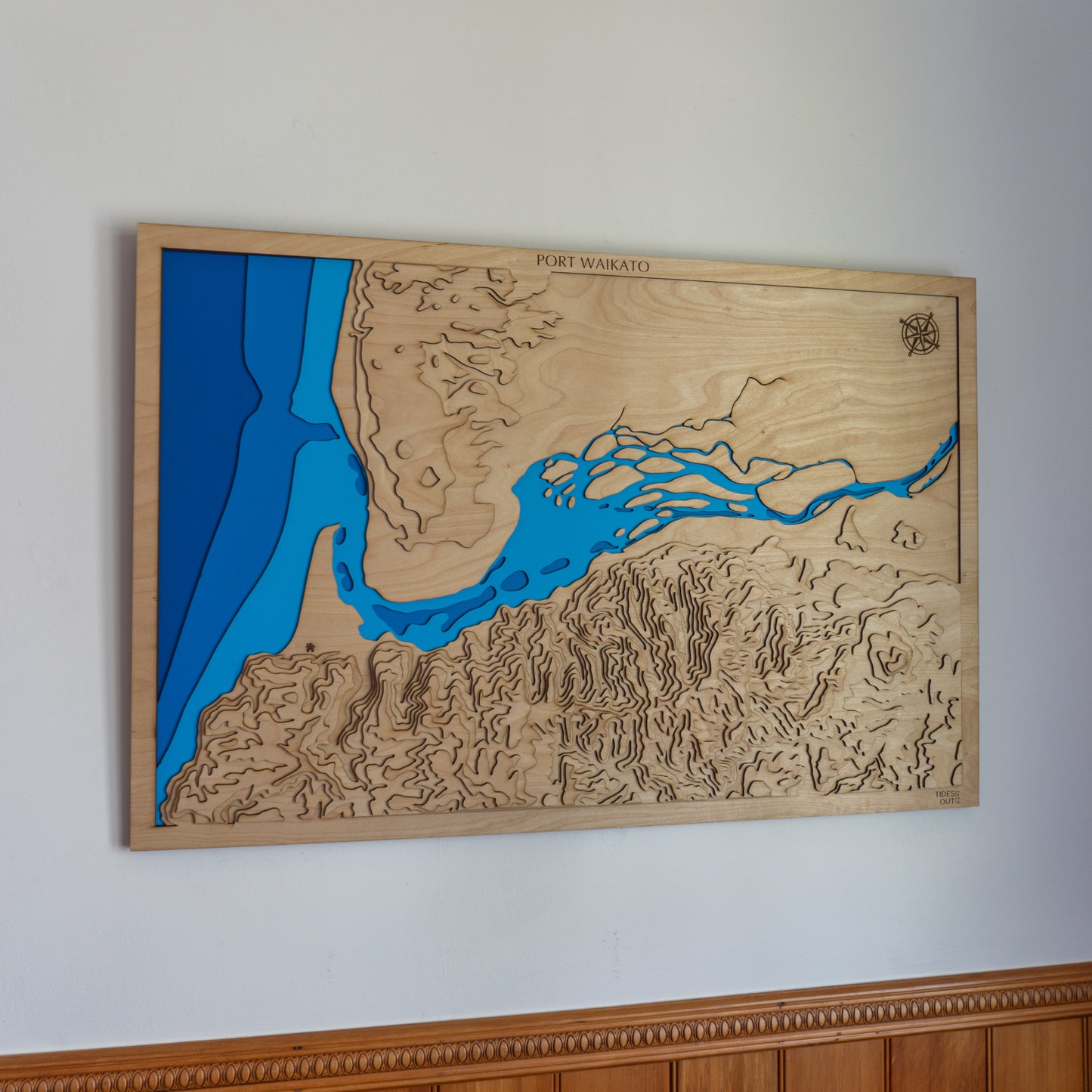
Port Waikato, Waikato, New Zealand – Large
Port Waikato, Waikato, New Zealand – Large
Couldn't load pickup availability
🌊 Port Waikato Wooden Ocean Depth Map – A Meaningful Gift for Ocean Lovers
Looking for the perfect gift for Dad, a standout piece of nautical wall art, or something special to celebrate a connection to New Zealand’s wild west coast? Our handcrafted wooden map of Port Waikato is made for ocean lovers, surfers, boaties, and those drawn to the meeting place of river and sea.
Each map is meticulously designed and made in Aotearoa, laser-cut from layers of European Birch plywood to reflect the unique depth contours where the Waikato River meets the Tasman Sea. With its clean lines and rich marine detail, this map brings the rugged beauty of Port Waikato to life.
🔍 Why People Love This Map:
-
A unique and thoughtful gift for birthdays, Father’s Day, or coastal weddings
-
Perfect for anyone who grew up surfing, fishing, or holidaying at Port Waikato
-
A statement piece for beach homes, living rooms, or offices
-
Proudly handcrafted in New Zealand using sustainable materials
📏 Size: XL (90 x 60 cm)
🪵 Material: European Birch plywood
🌊 Depth Layers: Sea level to -50m
🛠️ Made to order – please allow up to 2 weeks for crafting.
Want to add a custom engraving or create your own location? Explore our bespoke design options.