When you look at a Tides Out Map, you’re not just seeing a piece of wall art — you’re looking at bathymetry turned beautiful. But what exactly is bathymetry, and why does it matter when it comes to making handcrafted ocean maps?
In this post, we’ll break it down in plain English and show how this fascinating science shapes the stunning coastal artworks that hang on your walls.
🌊 What Is Bathymetry?
Bathymetry is the study and mapping of underwater depth of ocean floors, lakes, and riverbeds — essentially, it’s the underwater equivalent of topography. While topographic maps show mountains, valleys, and elevation on land, bathymetric maps show the depths, contours, and shapes of the seafloor.
You’ll often see:
-
Depth contours (called isobaths)
-
Underwater slopes and trenches
-
Sandbanks, reefs, and islands
-
Submerged geological features
Think of it as mapping the invisible — revealing the landscape beneath the waves.
🔬 Where Does Bathymetric Data Come From?
Bathymetric data is collected using a combination of:
-
Sonar (sound waves bounced off the seafloor)
-
Satellite altimetry
-
LIDAR (for shallow coastal areas)
-
Research vessels and hydrographic surveys
In New Zealand, much of this data is sourced from organisations like LINZ (Land Information New Zealand), and global scientific databases. It’s complex, raw information — but it forms the foundation for our map art.
🎨 How Bathymetry Becomes Art
At Tides Out Maps, bathymetry isn’t just data — it’s the beginning of the creative process.
Here’s how we use it:
-
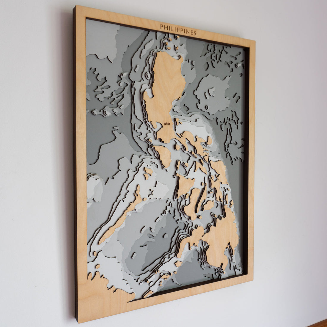
Layered Depths – We turn depth contours into distinct visual layers, with each representing a step deeper into the sea.
-
Map Sculpting – These layers are laser-cut from wood and stacked, creating a 3D effect that mimics underwater topography.
-
Design Flow – We balance accuracy with aesthetics, choosing which contours to keep and which to simplify for visual clarity.
-
Personal Touches – Once the bathymetric base is built, we add landmarks, labels, and custom engravings to tell a personal story.
🧭 Why It Matters: Bathymetry as a Bridge Between Science and Soul
Bathymetry is more than a technical term — it’s what makes our maps meaningful. It connects people to:
-
Boating memories — channels and sandbars they’ve navigated
-
Diving and fishing spots — underwater terrain they know by heart
-
Coastal places they love — from the Hauraki Gulf to hidden coves
By transforming bathymetry into tangible, tactile art, we give people a new way to experience their favourite places — not just as flat prints, but as dimensional pieces of their life story.
✨ Bringing Depth to Decor
So the next time someone asks, “What’s that map on your wall?” — you can tell them it’s more than just a map. It’s a piece of bathymetry, turned into wood, shaped by science, and brought to life by art.
Want to See Bathymetry in Action?
👉 Explore Our Handmade Ocean Maps Here
Or, take a peek behind the scenes:
🛠 How We Turn NZ Coastlines into Handcrafted Ocean Maps →
Shop Tides Out Maps bathymetric collections:
➤ Shop All Ocean Maps
Custom designs page:
➤ Create Your Bespoke Map