


Tide's Out Maps
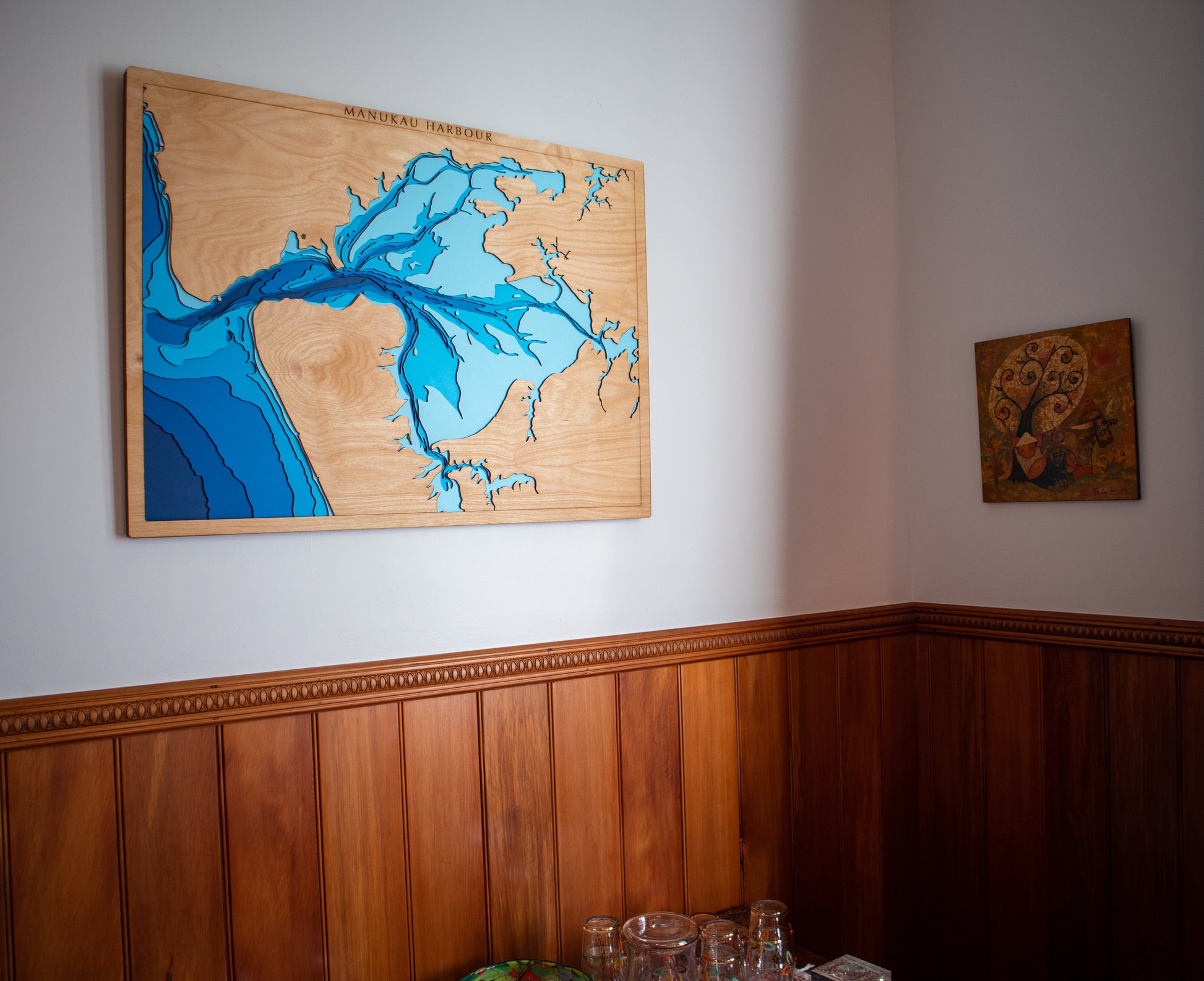
Manukau Harbour, Auckland, NZ | Large
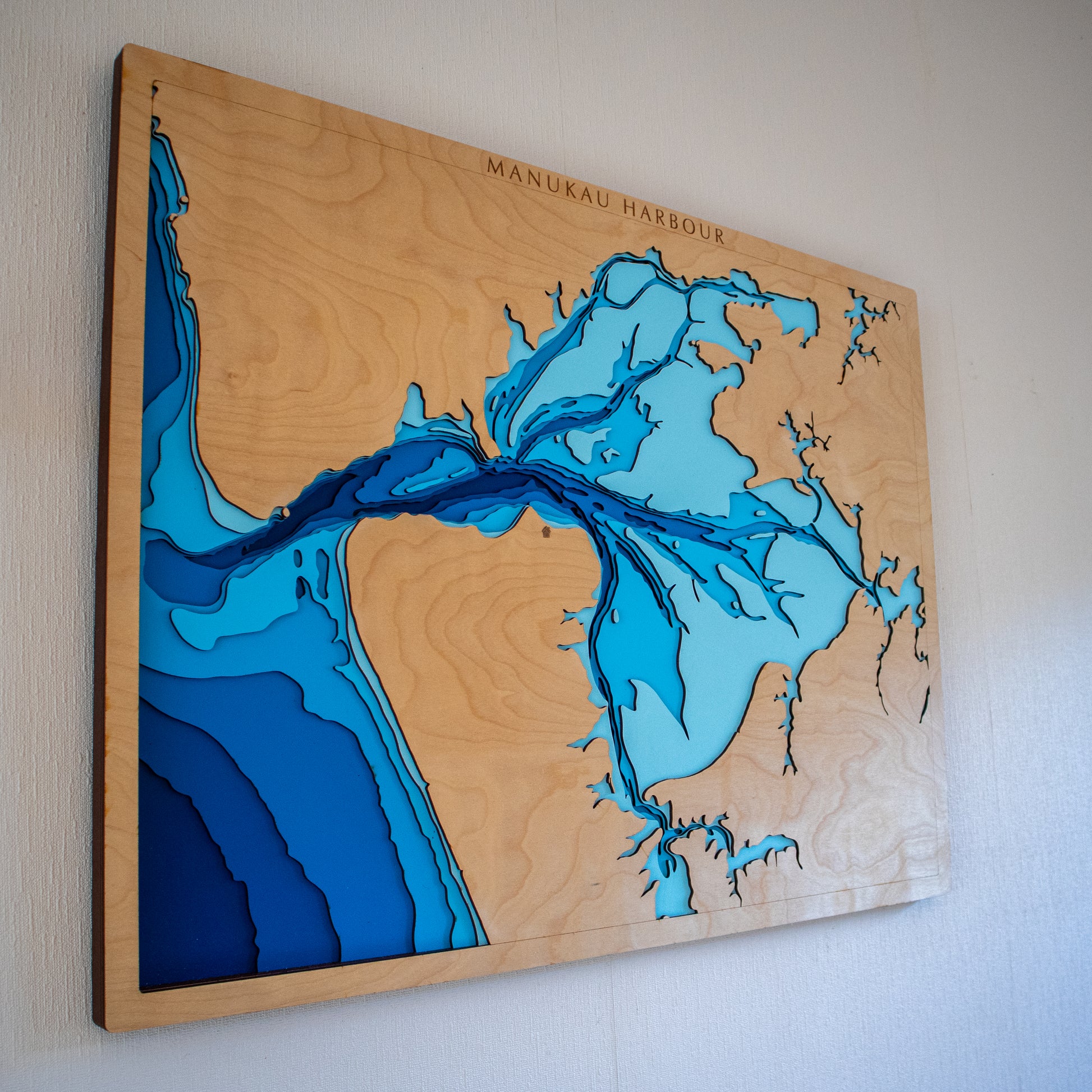
Manukau Harbour, Auckland, NZ | Large
Couldn't load pickup availability
For the boatie who knows the bar in every tide. The west-coast surfer who watches the harbour mouth from the dunes. The South Aucklander whose horizon is the Manukau.
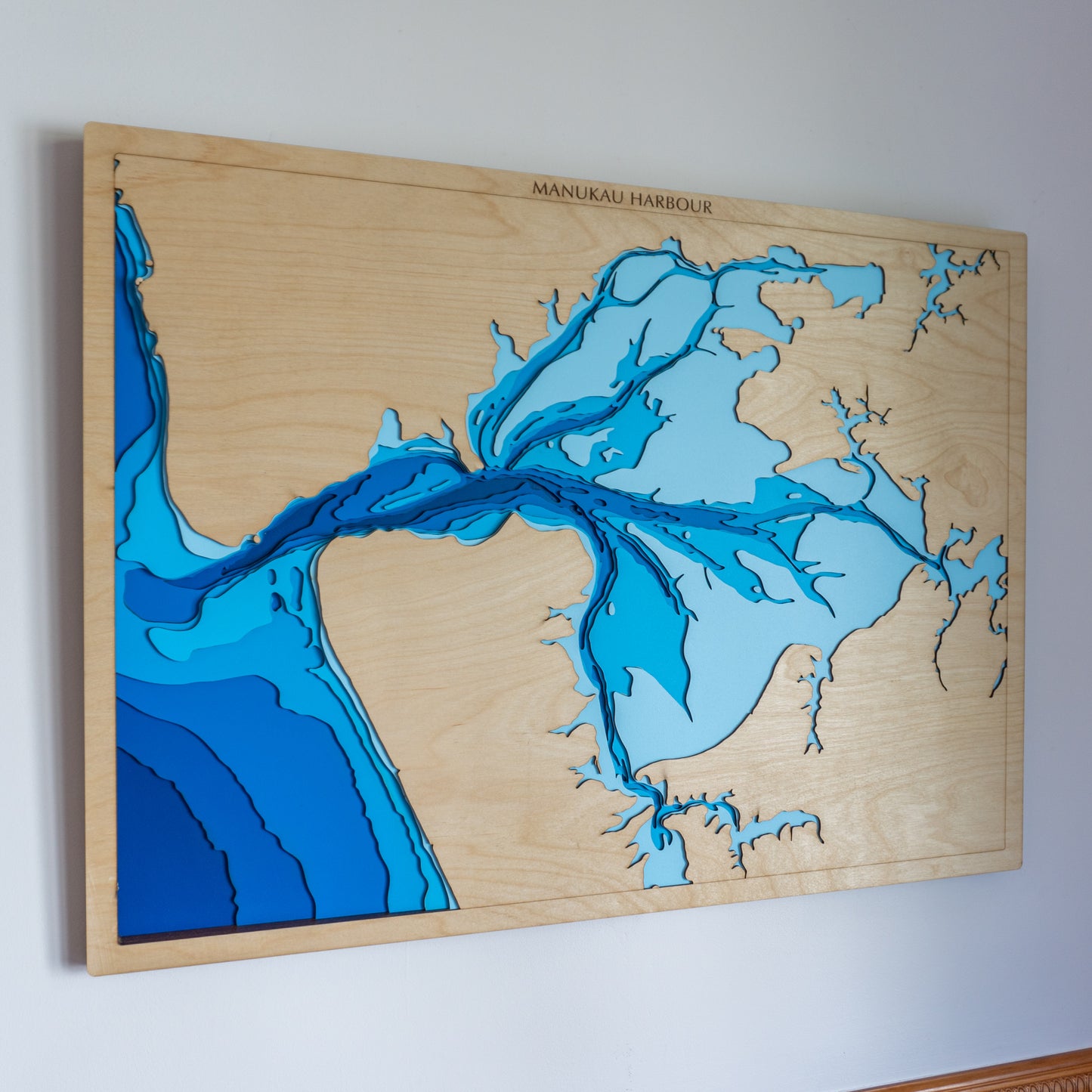
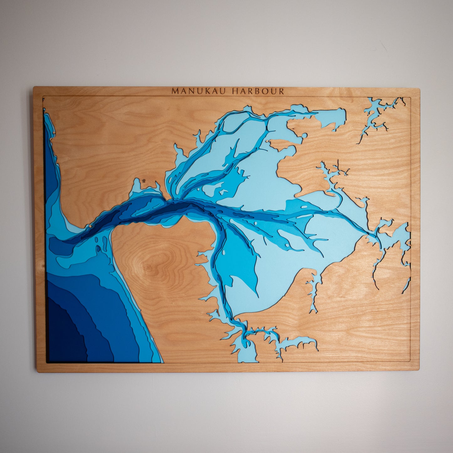
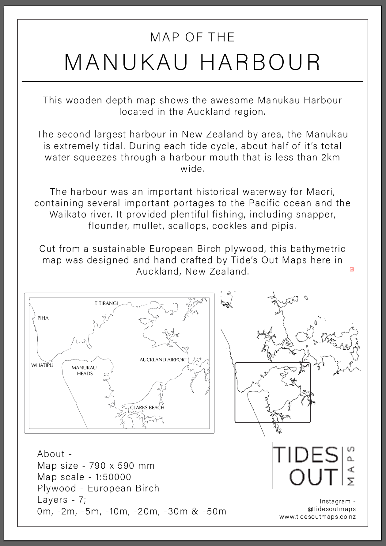
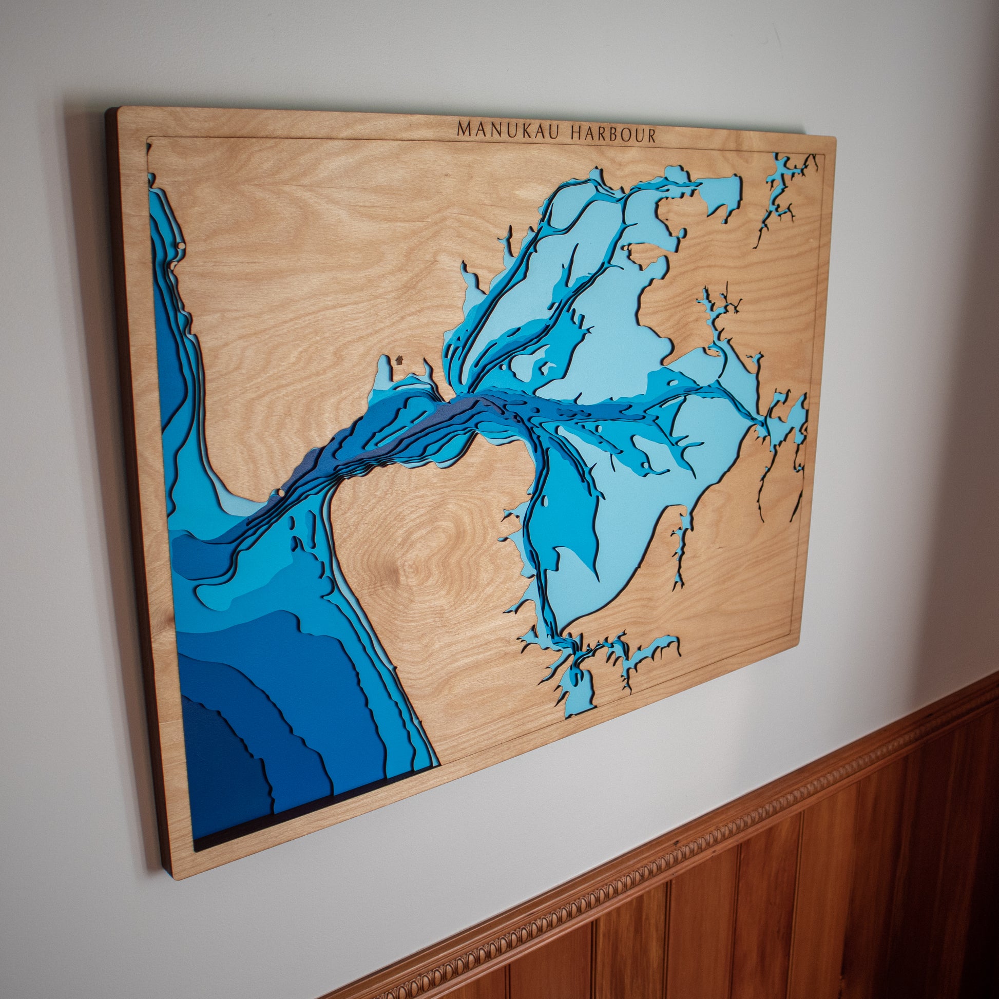
This handcrafted wooden depth map captures the Manukau Harbour — the wide tidal harbour west of Auckland, the channels carving through the sandbanks, the bar at the entrance and the open Tasman beyond. Laser-cut from premium European Birch in our Auckland studio, and hand-painted layer by layer to reveal the seafloor beneath.
Product details
Area: Manukau Harbour, Auckland
Size: Large — 60 × 80cm
Total layers: 7
Topography: 0m, −2m, −5m, −10m, −20m, −30m, −50m
Materials: European Birch Plywood, MDF, water-based paint, timber oil
Frame: Built into the map — comes strung and ready to hang
How they're made
Each map starts by sourcing the appropriate bathymetric data source. We spend hours in design making sure the contours appear smooth yet accurate, and the whole map feels balanced. From there, we paint and laser-cut sheets of wood to bring the underwater landscape to life. Every piece is assembled by hand by our team in our Auckland studio.
Every map is made this way — slowly, carefully, until the seafloor comes to life.
Handcrafted to order
Your map is made in our Auckland studio once you place your order — we don't keep stock on the shelf. Allow 10–14 days from your order date, and we'll keep you updated as yours is made.
Our current capacity is up to 15 maps per week — if you're ordering for a gifting deadline, please let us know and we'll do our best to accommodate.
Personalise it (+$50)
Want to mark a home fishing spot, a favourite anchorage, or somewhere that simply means something to you? Select "Personalised" above and leave a note at checkout telling us where to mark. We'll take care of the rest.
Note: some of our product photos show personalised engravings. Your map will arrive unmarked unless you request a personalisation.
Learn more about personalisations →
Common questions
What if I'm not happy with my map?
We offer a full guarantee on craftsmanship. If you're not happy when your map arrives — or any time in the next 12 months — let us know and we'll make it right. Our small team takes real pride in the build quality of everything we send out.
How long will it take to make?
Every map is made to order in our Auckland studio. Allow 10–14 days from your order date, plus shipping. If you need it by a specific date, get in touch and we'll do our best to accommodate.
Can I personalise it?
Yes — select "Personalised (+$50)" above and leave a note at checkout telling us what to mark. A bay, harbour, surf break, or anywhere that matters. If you're giving one as a gift, a personalised marker can make it feel extra special. See examples →
Will it be safe to ship?
Yes — we take extra care with our packaging to make sure your map arrives in perfect condition (in the rare case something goes wrong in transit, we'll replace it at no extra cost). We use NZ Post's courier service for everything within NZ.
Do you ship overseas?
Yes — we offer free shipping within NZ and Australia. If you're further afield, send us a message and we'll let you know the shipping cost to your country.
What if my area isn't on the map?
Get in touch — we may be able to create it. Email us or fill in our enquiry form with your request and we'll let you know what's possible.