


Tide's Out Maps
Stewart Island, New Zealand - Medium
Stewart Island, New Zealand - Medium
Couldn't load pickup availability
🗺️ Stewart Island Wooden Depth Map - Medium
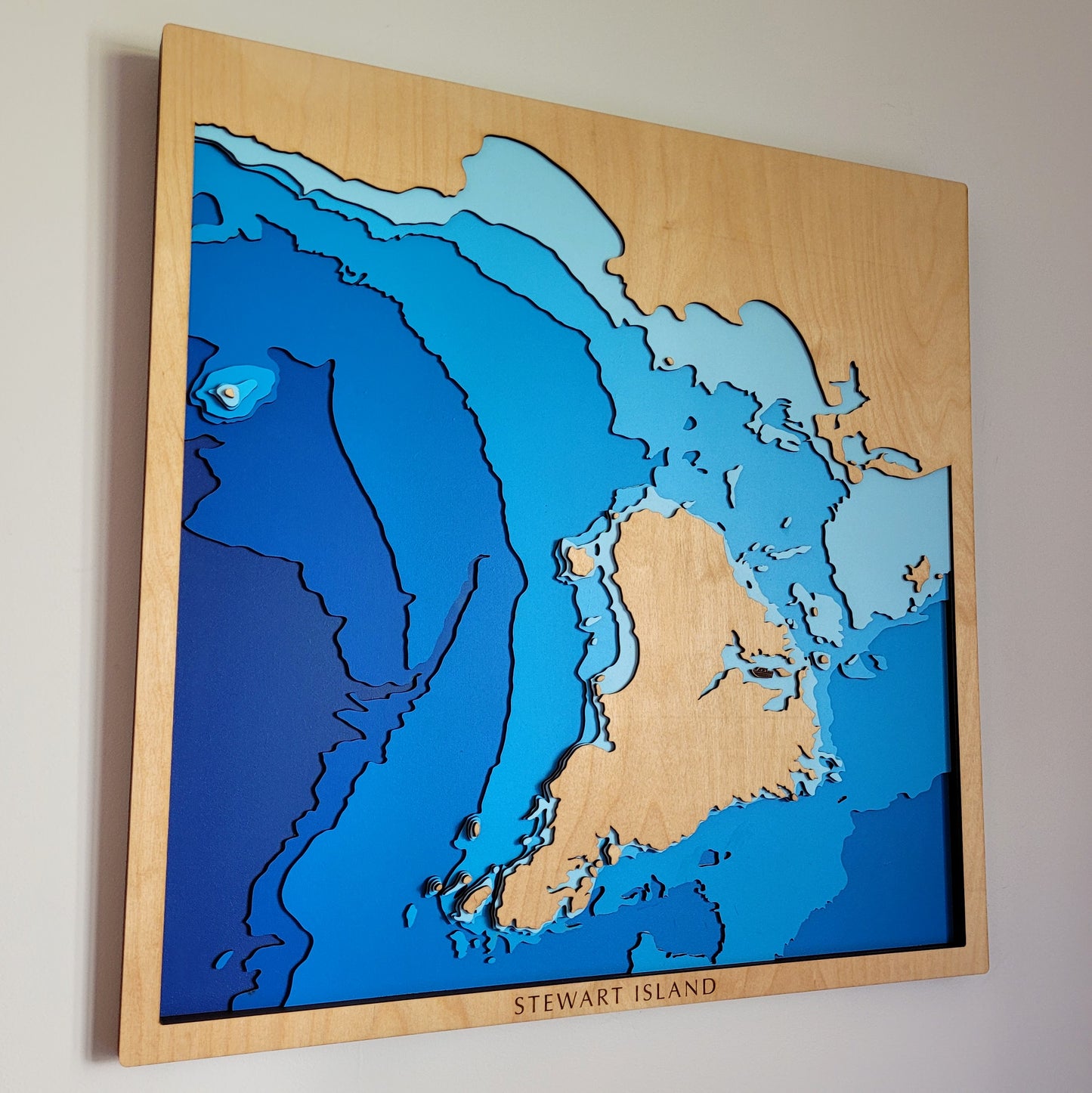
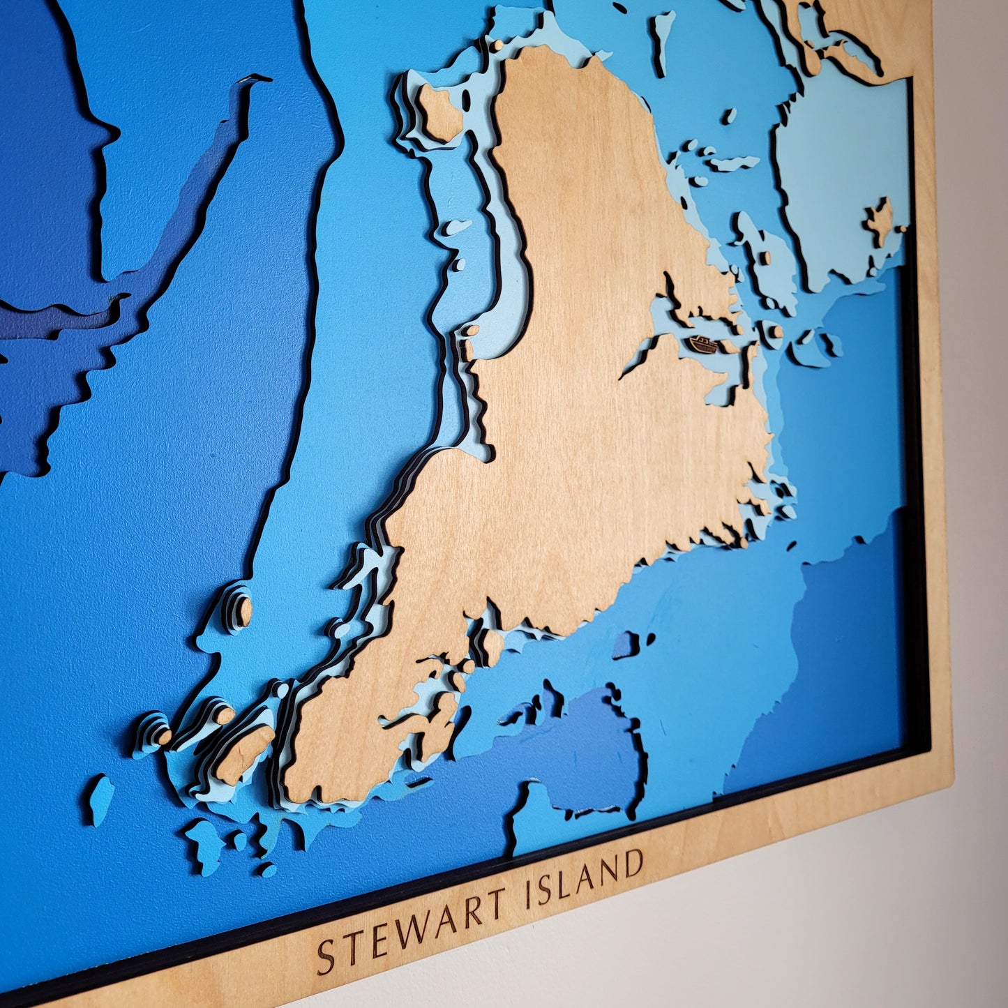
Discover the raw beauty of New Zealand’s southernmost island with this handcrafted wooden depth map of Stewart Island / Rakiura. Known for its untouched wilderness, rare wildlife, and rugged coastline, this piece brings the island’s unique character to life—layer by layer.
With 80% of the island protected as Rakiura National Park, Stewart Island is a sanctuary for native birds like the Kiwi, and home to one of New Zealand’s Great Walks. Whether it's a reminder of a tramp, a fishing trip, or a connection to the deep south, this map makes a stunning and meaningful addition to any wall.
🌿 Why You’ll Love It
-
Features Stewart Island’s terrain and ocean depths in layered relief
-
Handmade in New Zealand with sustainable European Birch plywood
-
Laser-cut and hand-assembled for rich topographic detail
-
A perfect keepsake for trampers, wildlife lovers, and Kiwis at heart
-
Optional customisation to add names, places, or memories
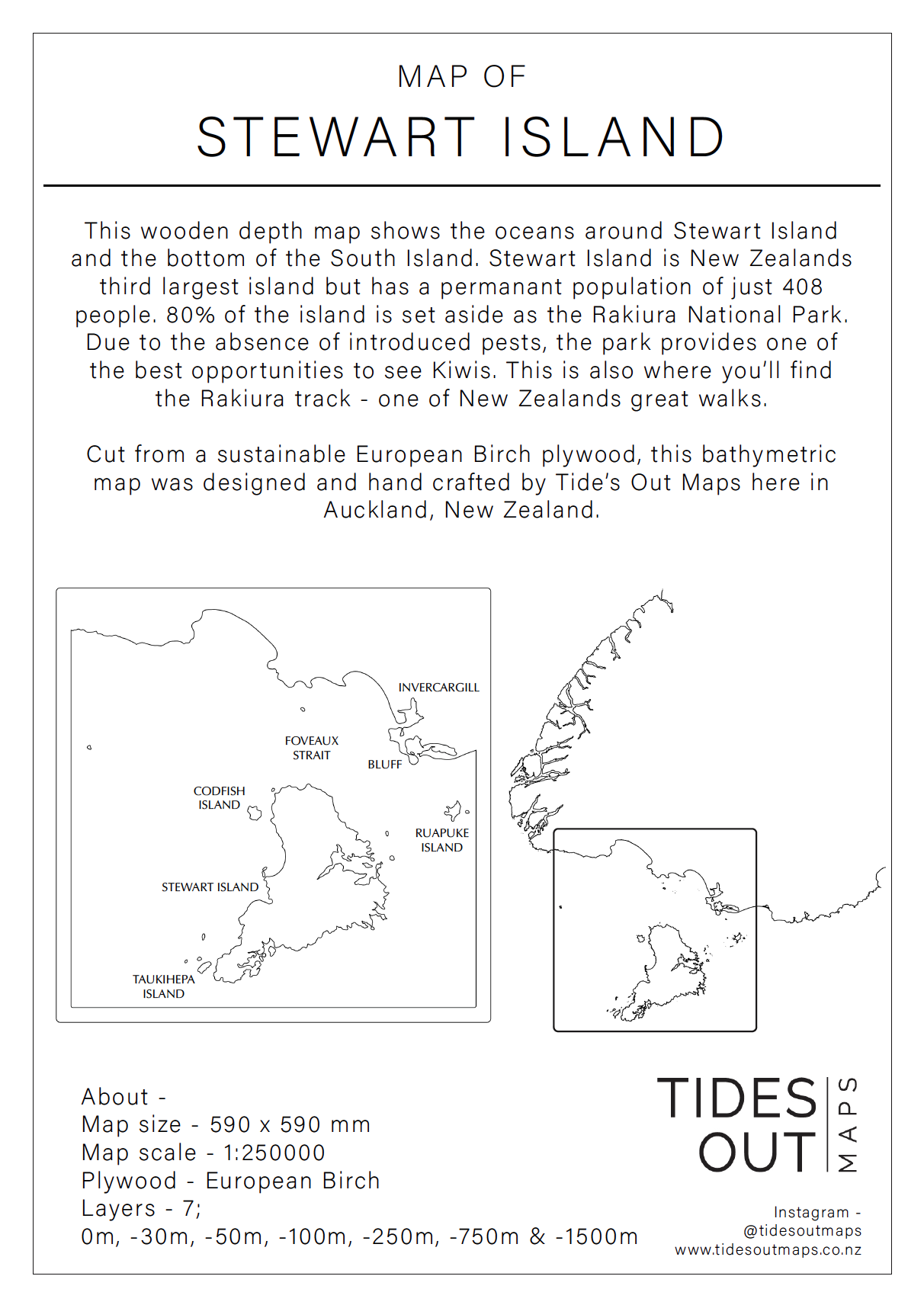
📏 Size: Medium (60 x 60 cm)
🪵 Material: European Birch
🌊 Layers: Sea level, -30m, -50m, -100m, -250m, -750m, -1500m
🛠️ Made to Order: Please allow up to two weeks for crafting
✍️ Want to personalise your map?
Click ‘Add a Bespoke Addition’ and leave a note with your order—we’ll be in touch to help customise it just for you.
Customer Reviews
No reviews yet for this product.