


Tide's Out Maps
Manukau Harbour, Auckland Region, New Zealand – Large
Manukau Harbour, Auckland Region, New Zealand – Large
Couldn't load pickup availability
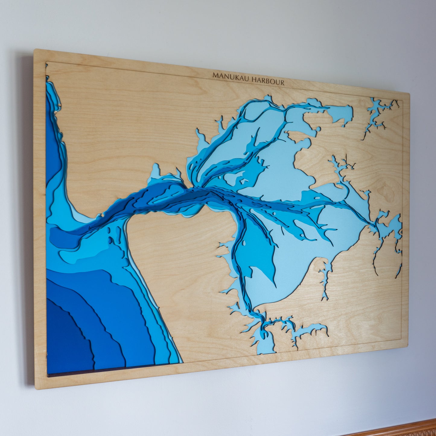
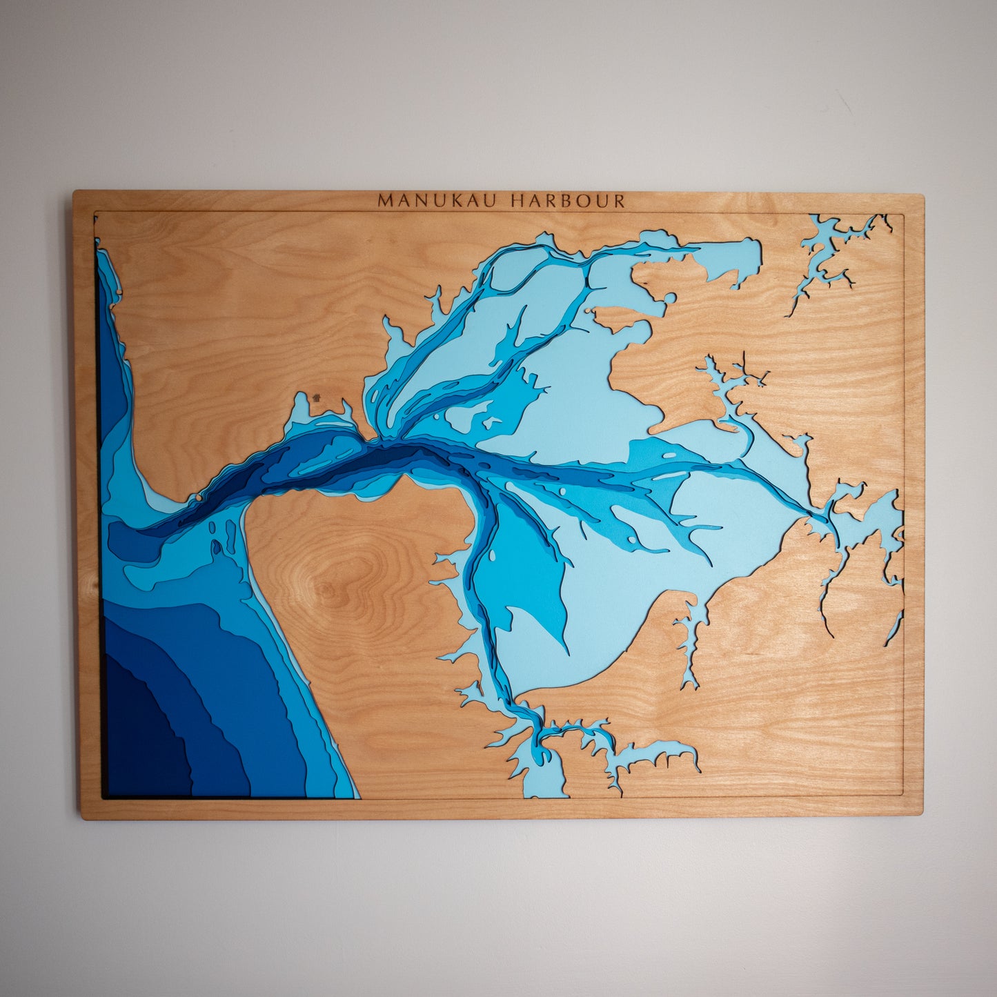
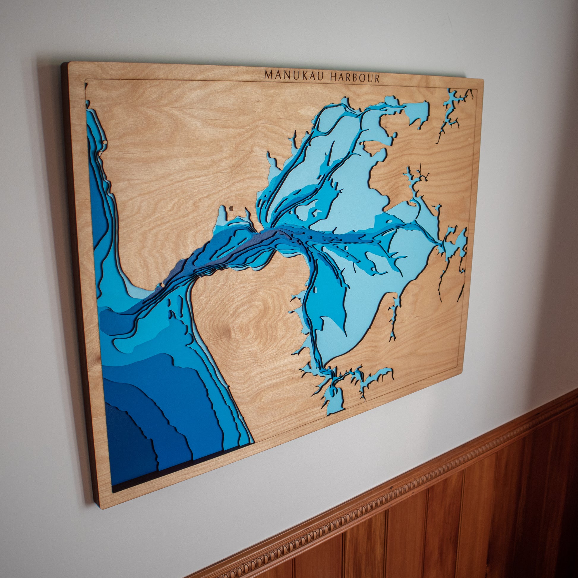
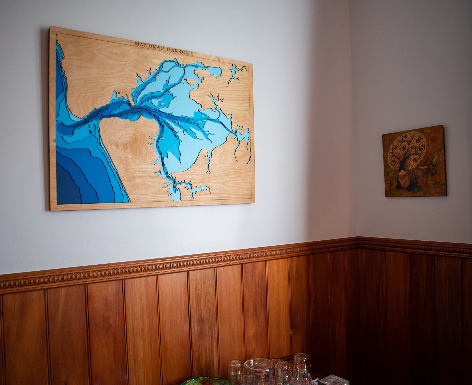
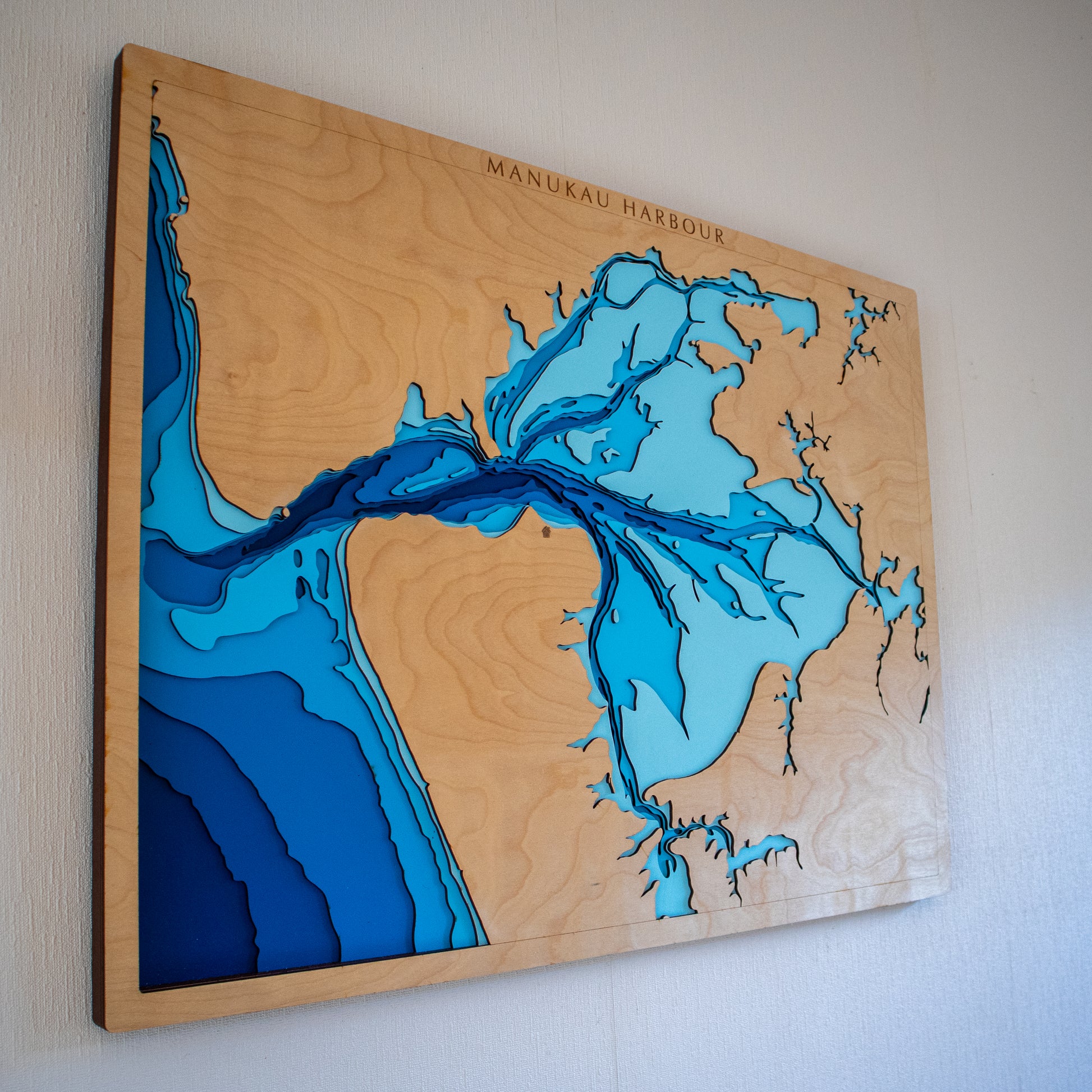
🌊 Manukau Harbour Wooden Depth Map – A Handcrafted Tribute to One of NZ’s Great Tidal Waterways
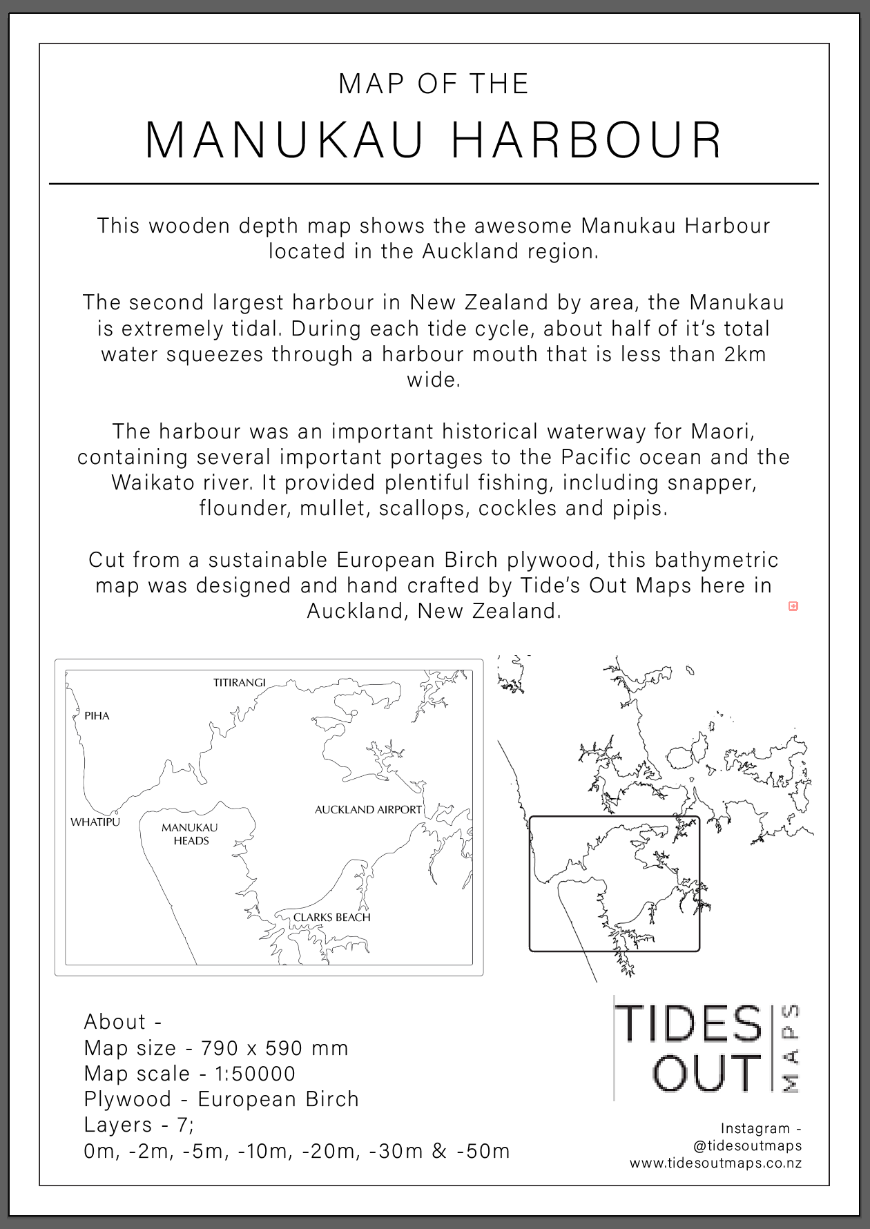
The Manukau Harbour is New Zealand’s second-largest harbour by area — a vast, tidal expanse with rich Māori history and natural beauty. With each tide, half its water surges through a narrow 2km-wide entrance, shaping the mudflats and sandbanks that make this harbour so distinctive.
This handcrafted wooden map captures the tidal nature of the Manukau in stunning layered relief. From its winding inlets to the harbour mouth, every contour is laser-cut and assembled by hand in our New Zealand workshop.
Whether it’s a reminder of time spent fishing, boating, or growing up nearby, this piece brings the story of the Manukau to life on your wall.
🔍 Why People Love This Map:
-
A meaningful gift for Auckland locals, boaties, or history lovers
-
Features the harbour’s unique tidal bathymetry and coastal features
-
Pays tribute to the area’s rich Māori heritage and natural abundance
-
Handcrafted in NZ from sustainable European Birch plywood
-
Optional engraving available for names, dates, or personal locations
📏 Size: Large (80 x 60 cm)
🪵 Material: European Birch 3-ply plywood
🌊 Depth Layers: Sea level, -2m, -5m, -10m, -20m, -30m, -50m
🛠️ Made to order – please allow up to 2 weeks for your custom-built map.
✍️ Want to personalise your map? Leave a note at checkout and we’ll be in touch to confirm your customisation.